France - Shrink-Swell Subsidence
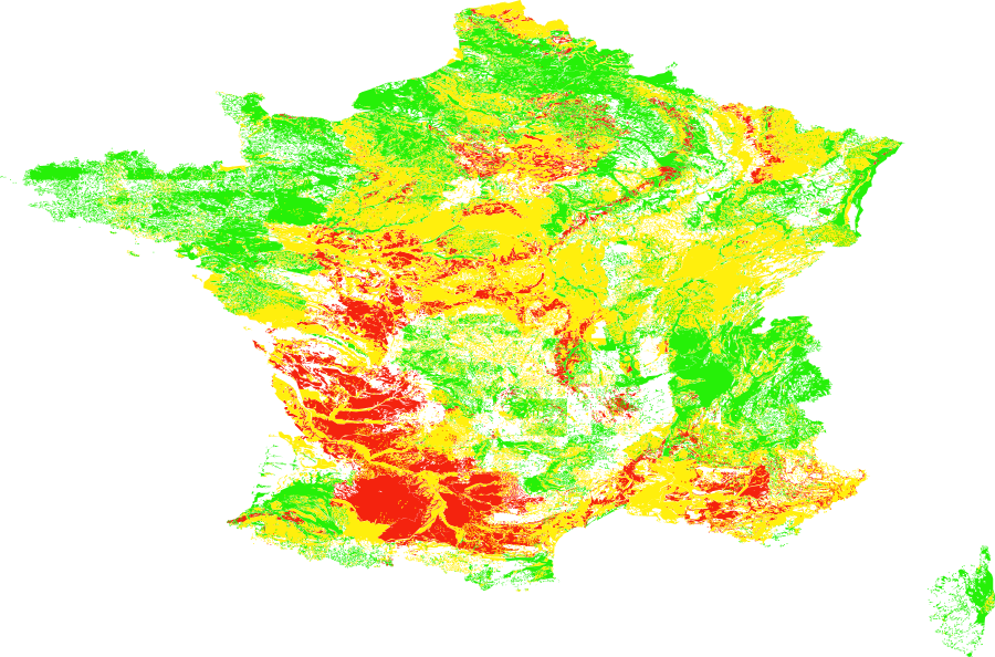
The France Shrink-Swell Subsidence (Exposition Argile) dataset is a national vector
layer mapping the susceptibility of clay-rich soils to shrink-swell movements across
France, produced by the French Bureau de Recherches Géologiques et Minières (BRGM).
Clay soils expand when wet and contract when dry — a process that causes ground
subsidence and heave, leading to structural damage to buildings (cracking of walls,
foundations, and slabs). This is one of the most costly natural hazards for residential
property in France and is covered under the French Natural Disaster (CatNat) regime.
Data Visualisation
Technical information
Data coincides with the actual GeoNetwork catalog record - this is our most recent verified data.
| Coverage | France |
| Data format | Vector |
| Projection | EPSG:3857 (Web Mercator) |
| Source | BRGM |
| License | Pending — not yet captured for this layer |
| Last updated | 2026-10-31 |
Interpreting the data
each polygon is assigned a clay shrink-swell hazard level via
the alea attribute — Faible (Low), Moyen (Medium), or Fort (High). Higher levels
indicate greater susceptibility to soil movement and associated building damage risk.
Areas classified Fort correspond to soils with the highest clay content and most
pronounced seasonal volume change. Risk is amplified during drought periods.
Resolution and update frequency
vector polygons; coverage limited to metropolitan France.
Updated periodically by BRGM as new geological surveys are incorporated.
Source
https://www.georisques.gouv.fr/risques/retrait-gonflement-des-argiles (BRGM / Géorisques — Retrait-gonflement des argiles). Open data; source acknowledgment required.
Related layers
| Layer | Why it's related |
|---|---|
| TODO | TODO |