Global Fire Hazard
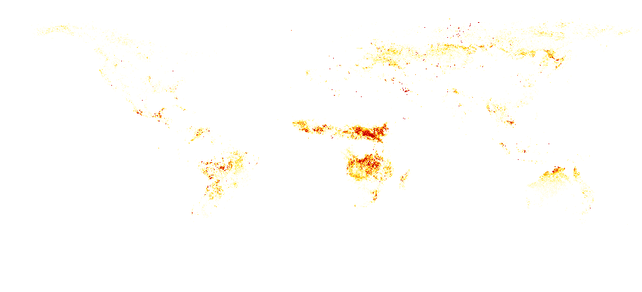
The Global Fire Hazard is a raster dataset derived from NASA MODIS satellite observations
of active fires across the globe. Pixel values represent fire occurrence frequency
expressed as fire detections per 1,000 km² per day, aggregated from thermal anomalies
detected by the MODIS Terra satellite (MOD14A1 product) over the period 2000–2020.
By capturing where fires have historically been most concentrated, this layer supports
environmental impact assessments, property risk modelling, and land management planning.
Data Visualisation
Technical information
Data coincides with the actual GeoNetwork catalog record - this is our most recent verified data.
| Coverage | Global |
| Data format | Raster (GeoTIFF) |
| Projection | EPSG:3857 (Web Mercator) |
| Resolution | ~11 km |
| Source | NASA |
| License | Pending — not yet captured for this layer |
| Last updated | 2026-10-31 |
Interpreting the data
values are classified into ten levels from Very Low (< 0.2 fire
pixels/1,000 km²/day) to Extreme (> 1.0), reflecting increasing historical fire frequency.
Areas with higher values have experienced more frequent fire events per unit area over
the observation period. [styling colour ramp to be confirmed]
Resolution and update frequency
approximately 1 km (native MODIS resolution), reprojected to
EPSG:3857. The dataset represents a long-term historical baseline (2000–2020) and
is not updated in real time.
Source
https://neo.sci.gsfc.nasa.gov/view.php?datasetId=MOD14A1_M_FIRE (NASA Earth Observations, MODIS Terra Active Fire — MOD14A1). Data use permitted with source acknowledgment required.
Related layers
| Layer | Why it's related |
|---|---|
| TODO | TODO |